M4 Smart Motorway.
Highway widening. A controlled working envelope.
- Client during construction
- Highways England
Now National Highways - Project delivery
- Balfour Beatty VINCI JV [2]
- My employer
- Balfour Beatty
- My work
- Highway & bridge-related excavation
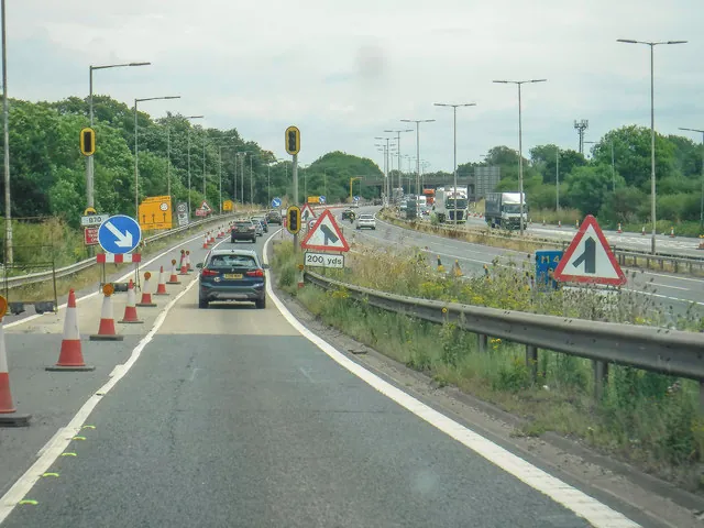
The M4 junctions 3–12 upgrade added running-lane capacity and traffic-management technology along the route between Hayes and Theale. National Highways records construction from 2018 to 2022; the wider scheme covered 32 miles and replaced 11 overbridges to make room for the additional lane [1] [2]. My work was on highway widening and bridge-related excavator operations around Maidenhead.
Highway widening
Working on the M4 Smart Motorway upgrade, I undertook excavation, earthworks and ground preparation supporting additional lane construction. I carried out formation preparation within an active motorway construction environment, controlling the excavation to the required levels and work area.
Maidenhead — bridge-related works
I also operated excavators on bridge-related works in the Maidenhead area. An important part of this assignment was using machinery equipped with slew and height restriction systems. The task demanded careful control of the boom, attachment and machine rotation within the permitted working envelope near live motorway infrastructure.
Understanding the operating envelope
Slew restriction limits rotation towards a defined restricted area. Height restriction limits the permitted vertical reach of the working equipment. Together, these functions help keep machine movement within set boundaries. Manufacturers describe systems that monitor these limits and, depending on configuration, warn the operator or restrict motion [4].
I worked within the limits established for the operation. These systems formed part of controlled construction operations alongside site procedures, traffic management and operator awareness. They were one part of managing the work near live traffic.
Making space for the new lanes
The scheme converted hard shoulders to running lanes and widened constrained sections. Its bridge programme included replacement overbridges and widening the existing motorway bridge over the Thames at Bray [3]. Those wider structural works explain the complexity of the corridor; my contribution was the excavator work described above.
This experience combines formation work with spatial discipline: understanding the available operating area, controlling the excavator precisely and keeping the work within the defined construction boundaries.
Official project references.
- National Highways — completed M4 junctions 3–12 scheme, programme and scope ↗
- Balfour Beatty — 32-mile scheme and bridge replacement programme ↗
- Highways England — Thames Bray widening, with official construction photography ↗
- GKD Technologies — explanation of height and slew monitoring principles ↗
Project facts checked 4 November 2026. Programme descriptions refer to the works as delivered, rather than current smart motorway policy. The manufacturer reference explains the technology; it does not identify the system I used.